
|
| ■Higashiyama Course (from Fushimi Inari Station to Hiei Station of Cable Car, 24.6km) |
| From Inari to Keage (Trail Board Number from1 to 31) |
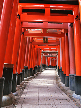 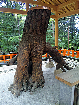 |
| Left: Senbon Torii (thousands of red Torii Shinto gates), Right: Neagari-matsu Pine Tree of Hizamatsu-san |
|
Higashiyama Course of the Kyoto Trail starts from Fushimi Inari Station of Keihan Line. Trail Board Number 1 is placed in front of the station and Guide Board is placed beside the park east of the station. There are many shops of ritual articles and souvenirs both sides of the shrine's approach to Fushimi Inari Taisha Shrine across the JR crossing. Inari Shrine is always full with visitors who wish for the success in business but the god of agriculture was originally enshrined. Go up the wide stone steps next of the main hall and go right to Senbon Torii (thousands of red Torii Shinto gates). The Torii way is divided into two ways. Both ways lead you to the Oku-no-in (penetralia). There is an “Omo-karu-ish Stone” at the right back of the main hall. If you lift up the stone and feel it light, it is said that your wish will come true. Trail Board Number 2 is on the side of the Northern Torii Shinto gate. Go up a pilgrimage way to Mt. Inari-yama through the torii gate. There is a “Neagari-matsu Pine Tree” beside a shrine on the left. This pine tree is renowned for its ability to fulfill the wishes for relief of backache and stiff shoulder. Go up the slow stone steps to “Kodama-ike Pond (Shin-ike Pond). It is said that you will find a person whom you are looking for in the direction of the echo of your claps when you clap your hands toward the pond. Go up the slow steps further to “Mitsu-tsuji”, the junction of three streets, and turn right and go up a stone stairs of 400 steps to “Yotsu-tsuji”. This stone stairs is called “Santoku-san no ishidan”. |
  |
| Left: Yotsu-tsuji (Mitsuke-no-mine), Right: Sennyu-ji Temple (Hall housing) |
|
“Yotsu-tsuji” (Trail Board Number 3-1), also called ”Mitsuke-no-mine” or “Ishi-doro”, is a good scenic lookout point and also is a good place for a rest. In the past, Osaka Castle Tower and Fushimi Castle Tower could be seen in the distance from here. Go through the Torii gate which is left side of the Trail Board Number 3-1, and go up the stone stairs to “Kojingamine”. From the Trail Board Number 3-2, take a path of “Gokobe-no-michi” on the left side of Kojingamine. Go down a narrow paved road to a residential area (Trail Board Number 4). From No.4 point, go down an unpaved slope to the right and cross the bridge over Sannohashi-gawa River at Trail Board Number 5-1. If you go down through a quiet residential area to the left from Trail Board Number 4, you can visit Tofuku-ji Temple. This temple is the headquarters of the Rinzai sect, Tofuku-ji Group, founded by Michizane Kujo. Its honorific mountain prefix is “Keinichi-san.” Its principal image is Shaka Nyorai. Go through a residential area and go up a slope between fences from Trail Board Number 6-2. There are some Imperial Mausoleums along the path. As this is a residential area, please do not give any annoyance to the general public living in the vicinity. |
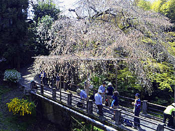 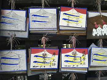 |
| Left: Ichinohashi Bridge and weeping cherry tree blossoms, Right: votive picture plates with illustrations of flying fishes at Tsurugi jinjya Shrine |
|
Sennyu-ji Temple is located at the foot of Mt. Tsukiwa-yama which is one of the Higashiyama 36 Mountains. Allegedly, this temple was originally a hermitage where Kobo-Daishi lived in Tencho period. The sects of this temple are Tendai, Shingon, Zen and Jyodo. This temple has been connected with the Imperial family after Emperor Shijyo was buried in this temple in Ninji period and then successive Emperors' Mausoleums were built. It is called Mitera as the imperial family's temple respectfully. Go down a wide approach to a stone marker of Hiden-in Temple at the corner of a playing field on the left side of the path. This is one of the sub-temples of Sennyu-ji Temple. You can enjoy a large panorama of Kyoto City from the temple grounds. Trail Board Number 7 is placed in front of the entrance of the approach of Hiden-in Temple, at the fork to Imakumano-kannon. Pass under the bridge at Trail Board Number 8 (right path). The north peak faced Imakumano-kannon is Amida-mine, and west side of the peak is called Toribeno. Imakumano-kannon is the 15th temple of the Saigoku 33 Kannon Pilgrimage. These days it is worshipped as a temple for literature. Cross Ichinohashi-gawa River and turn to the right at a sharp angle at Trail Board Number 9-1 seeing the Torii gate of Tsurugi-jinjya Shrine at the front. This shrine is famous for a charm for curing children's tantrums. The path leads you to a residential area. Cross Suberi-ishi Kaido at Trail Board Number 10. From Trail Board Number 11, take a mountain path to Mt. Rokujyo-yama. This path is also a part of “Kyojyo Toribe-no mori” path. Go on the slow slope to Trail Board Number 12. If you go down to the right at Trail Board Number 12, you will reach the road to the Kyoto City Funeral Hall. And if you go straight through Trail Board Number 12, you will reach Amidagamine. There is Hokoku-byo Reliquary Shrine on the top. Go along Route 1 from Trail Board Number 14 and cross Shibutani-kaido at Trail Board Number 15-1. There is no pedestrian crossing, and so please cross the road with full attention to cars which are turning to the left from Route 1. Pass through a pedestrian's tunnel under Route 1. After going up the steep stone stairs from Trail Board Number 16-1, you will see the Mausoleum of Emperor Takakura ahead. High point of the upper right is “Uta no Nakayama Seikan-ji Temple” built in 802. This temple is very well known for its beautiful cherry blossoms and marvelous red leaves. Many Tanka poems related to this temple have been written. Kaname-ishi Stone is also famous. |
  |
| Left: Slope to Mt. Kiyomizu-yama from Seikan-ji Temple, Right: Branching point to Kiyomizu-dera Temple (Trail Board Number 19) |
|
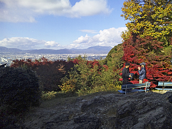
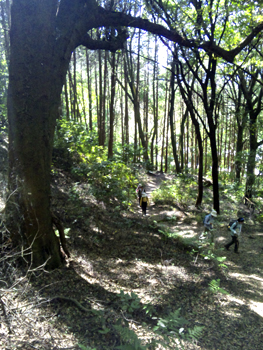
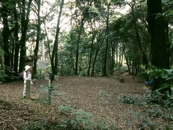
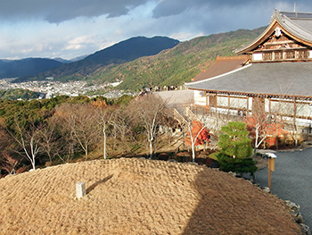
Go to the north on the path to the South Gate of Kiyomizu-dera Temple to Trail Board Number 16-2. Beside the Trail Guide Board, there is a stone Jizo statue. Trail Board Number 17 is a starting point to Mt. Kiyomizu-yama. On the right hand side on your way, there is an old big stone 3-storied pagoda. Keep going up the slope further. After the slope becomes slow, you will reach Trail Board Number 18-1. Just east side of it, the triangulation point of Mt. Kiyomizu-yama (242.2 m) is placed. The path going down from the top of the mountain crosses a new work road of Forest Administrative Office at Trail Board Number 18-2. Go to Trail Board Number 19 in shady open space. Turn to the right and go down to the open space with a bower. From Trail Board Number 20, go up along the artificial water pond. As the path is very slippery, please walk on the path carefully. You will reach the Higashiyama Sancho Koen Park. The viewing platform is always full with visitors. |
  |
| Left: Shogun-zuka (view of Mt. Hiei-zan and Mt. Daomonji-yama on the Trail Course), Right: Sonsho-in Temple |
|
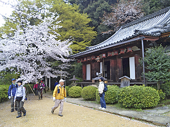
In Dainichi-do Hall of Shoren-in Monzeki, there is Shogun-zuka Mound. The temple grounds are impressive at any time of the year; green leaves in spring and fall foliages in autumn. Go into a mountain from Trail Board Number 22 which is placed in front of Dainichi-do Hall. Take the right path at Trail Board Number 23 and go toward north. If you go straight through Trail Board Number 23, you will reach Maruyama Park, and if you turn left at the fork of Trail Board Number 24, you will go down to Chion-in Temple. If you keep walking on the Kyoto Trail, turn to the right both at Trail Board Number 23 and at 24. After seeing the garden of Westin Hotel on your right, go through the tree grove to Sonsho-in Temple. The principal image is Genzan Daishi who is allegedly the founder of Omikuji (fortune telling slips). There is a carving of the three wise monkeys of “Mizaru” (see no evils) “Iwazaru” (hear no evil) and “Kikazaru” (hear no evil). Go through the grounds of the Temple and go down to Awta-sanso Villa. Go east along the wall of Shirakawa Elementary School. The path is former Tokai-do Road. Turn to the right at Trail Board Number 28 to Awata-jinjya Shrine. The entry and exit-gate of the old Tokai-do in Kyoto was called “Awataguchi” in the past; one of the seven gates of Kyoto. In the past, many travelers visited Awata-jinja Shrine to pray for safety travel. If you go further to the east along the small path running in front of Awata-jinjya Shrine, you will reach Ryoon-ji Temple related to the egg plant shape iron pot which Hideyoshi loved and used very much. There is Doin-jizo stone statue in the grounds. Go through the stone-paved approach of Awata-jinjya Shrine, and you will reach San-jo Street. Take the road to the east. You will find a temple gate of Bukko-ji Temple on your right. This is the Mausoleum of Shinran Shonin. There is a monument of Sanjyo Kokaji Munechika in the temple grounds. |
 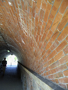 |
| Left: Incline, Right: Nejiri-Manpo (a peculiar tunnel made up of red bricks) |
|
Trail Board Number 30-1 is placed in front of Westin Miyako Hotel. Cross the pedestrian's crossing two times toward the stone wall of Incline across San-jo Street. The brick building is old Keage Hydro Power Plant. Using electricity generated at this plant, Japan's first ever electric train service was launched in Kyoto City in1895. If you cross Niomon Street at the signal and go to the left, you will reach Nanzen-ji Temple and Okazaki area. If you turn to the right along the stone wall of Incline, you will reach Nejiri-Manpo (a peculiar tunnel made up of bricks). (Trail Board Number 30-2) 《Approximate time required》 Fushimi Inari Station of Keihan Line (No. 1) (15min.← →15min.) Oku-sha (No.2) (20min.← →25min.) Yotsu-tsuji (No.3-1) (30min.← →25min) Sennyuu-ji Temple (No.7) (25min.← →25min.) Crossing point on Suberi-ishi Raod (No.10) (35min.← →35min.) Crossing point on Shibutani Kiaido (No.15-1) (30min.← →35min.) Mt. Kiyomizu-yama (No.18-1) (25min.←→25min.) Higashiyama Park (No.21) (60min.← →40min.) Nejiri-Manpo (No.30-2) (1min. ← →1min.) Keage Station of the Tozai Subway Fushimi Inari Station of Keihan Line (No.1) (4hours← →3hours and 45min.) Keage Station of the Tozai Subway |
| → Higashiyama Course (Trail Board Number from32 to 52-1) |
| →High points |
| → Back to the Top of this Page |
| © Kyoto Trail Guide Association |