
|
| ■Kitayama East Course (from Hiei Station of Cable Car to Ninose, 17.9 km) |
| From Ohara/Ide to Ninose (from Board Number 24 to Number 46) |
  |
| Left: Ebumi-jinjya Shrine, Right: Shizuhara district |
|
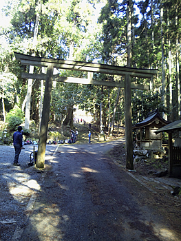
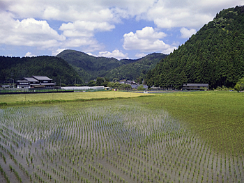
Go down the slope from Board No. 24 which is placed at Todera Bus Stop beside the mail box. Cross the bridge across Takano-gawa River and turn to the right at Board No. 26-1. Inside of Ide-cho Town, turn to the right at the corners. Turn to the left on the near side of the bridge over Miya-gawa River (Board No. 27) to Ebumi-jinjya Shrine. Cross the pavement which connects Ohara district and Shizuhara district and go up to the mountainside on the path which heads to the approach of Ebumi-jinjya Shrine. Turn to the left on the near side of the material storage yard at Board No. 29. Cross the stream and get into the old path heading to Ebumi-jinjya Shrine. Since ancient times, this shrine has been worshipped for the guardian deity of Ohara-go village and is a former village shrine. Its enshrined deity is Uganomitama no Mikoto. Mt. Ebumi-yama behind the shrine has been called “Mt. Konpira-san” as Konpira-gu Shrine in Sanuki District and Retired Emperor Sutoku were enshrined near the top of the mountain. This mountain is popular for its rock climbing wall among mountaineers in Kansai region. Cross the road at the pass and go down among the cedar forest. You will reach Shizuhara Village after crossing the bypass at Board No. 33. |
  |
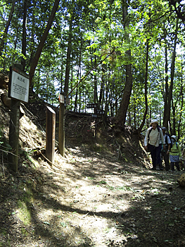
| Left: Shizuhara-jinjya Shrine, Right: Nison Board Monument on Yakkozaka-slope |
|
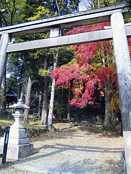
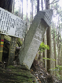
Take the right path at Board No. 34. You will reach Shizuhara-jinjya Shrine (Board No.35-2) in Shizuhara Village. The park next to the shrine is a good place for rest with toilet facilities. In autumn, leaves of gingko, maple, etc. turn to red and yellow beautifully. Pass by Board No. 36, 37 and sub-boards carefully and get into the right valley from Board No. 38. Turn to the left at Board No. 39-1. Yakko-zaka Slope which leads you to Kurama starts from here. The beginning is a paved steep slope. Under the old tree, there is Mida Nison board monument carved in Nanboku-cho era. Soon you will reach the top of the pass. |
 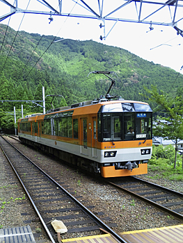 |
| Left: Yakko-zaka Pass, Right: Panoramic Eizan train “Kirara” |
|
This pass was opened in Heiancho era as well as Ebumi-toge Pass. After passing by a hokora (small shrine) of the mountain god in a quiet atmosphere, soon you will reach Kurama (Board No. 42). Turn to the left at Board No. 43 at the Kurama-kaido Road and go toward Kurama Station of Eiden. At the corner where the Kurama-kaido Road turns to the left, you will find the magnificent temple gate of Kurama-dera Temple, the Head Temple of Kurama-kokyo Sect on your right side (mountain side). As the Kurama-kaido Road is crowded with cars and trucks, using trains from Kurama to Ninose is recommended. Currently, no Trail Boards are placed between Kurama and Ninose. Going up along Kibune-gawa River for about 30 minutes from Kibuneguchi Station, you will reach Kibune area which is famous for Kibune-jinjya Shrine and Kawadoko (riverside summer terrace). |
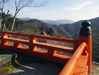 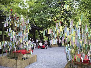 |
| Left: Kurama-dera Temple (Mt. Hiei-zan in the background) Right: Kibune-jinjya Shrine (Water Festival at Tanabata Festival) |
| 《Approximate time required》 Todera Bus Stop (No.24) (20min.← →25min) Entrance of the approach to Ebumi-jinjya Shrine (No.28) (25min.← →35min.) Ebumi-toge Pass (No.31) (30min.← →25min.) Branching point to Shizuhara (No.35-1) (15min.← →20min.) Starting point to Yakko-zaka Pass (No.39-1) (20min.← →30min.) Yakko-zaka Pass (No.40) (30min.← →25min.) Kurama Station of Eiden Kurama Station of Eiden〈20min.← →15min.〉Ninose Todera Bus Stop (No.24) (2hours and 20min.← →2hours and 40min.) Kurama Station of Eiden Kurama Station of Eiden - Ninose Station of Eiden |
| → Eastern Kitayama Course (Trail Board Number 1 to 23 of Kitayama Course) |
| → Western Kitayama Course (Trail Board Number 47 to 68 of Kitayama Course) |
| → High points |
| → Back to the Top of this Page |
| © Kyoto Trail Guide Association |